A “parade” of storm systems affecting B.C. may extend up to hit Prince Rupert and the North Coast by Thursday (Nov. 25) Environment and Climate Change Canada (ECCC), announced on Nov. 22.
High levels of precipitation from a series of storms are expected in the North Coast region, which may result in snow and ice, then high runoff after melting.
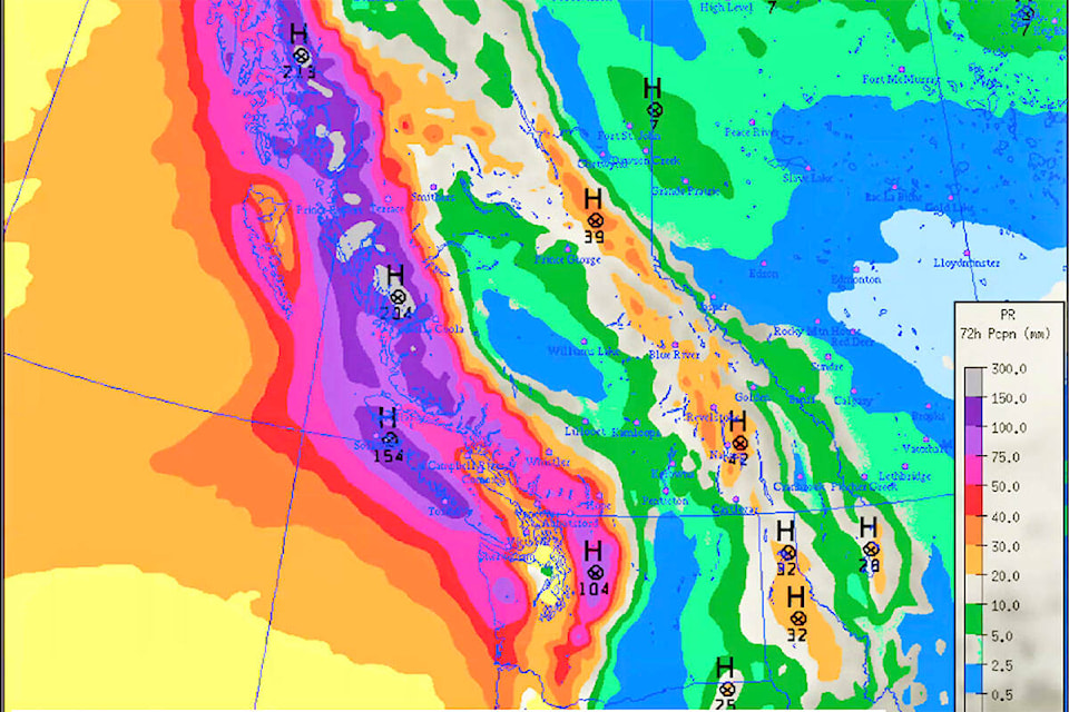
“As that [new] system curls further north up the coast, particularly on Sunday and even into early Monday, those [precipitation] values will be fairly high again,” Armel Castellan, warning preparedness meteorologist for ECCC, told The Northern View at a technical briefing.
“I couldn’t say this more succinctly … there’s really a parade of storms, one after the next after the next,” Castellan said.
Following on the back of a Nov. 19 special weather statement, which was then upgraded to a weather warning, up to 150 mm of rainfall was recorded on the North Coast and Haida Gwaii. This led to a flood watch being issued by the River Forecast Centre on Nov. 20 for both regions, which was downgraded on Nov.22.
READ MORE: Atmospheric River pointed at the North Coast and Haida Gwaii
The flood watch was reduced to a high streamflow advisory for the North Coast and has ended on Haida Gwaii, Nigel McInnis, of Forests, Lands, Natural Resource Operations and Rural Development, told The Northern View, on Nov 22.
Upcoming temperatures for Nov. 26 to 29 will hover around freezing in the surrounding North West municipalities.
Areas such as Kitimat, Terrace and Stewart can anticipate seeing snow in the forecast followed closely by rain, Castellan said.
Norman Galimski | Journalist
Send Norman
Like the The Northern View on Facebook
Follow us on Twitter