Just south of Prince Rupert, World War II structures still stand, but the question now is for how much longer.
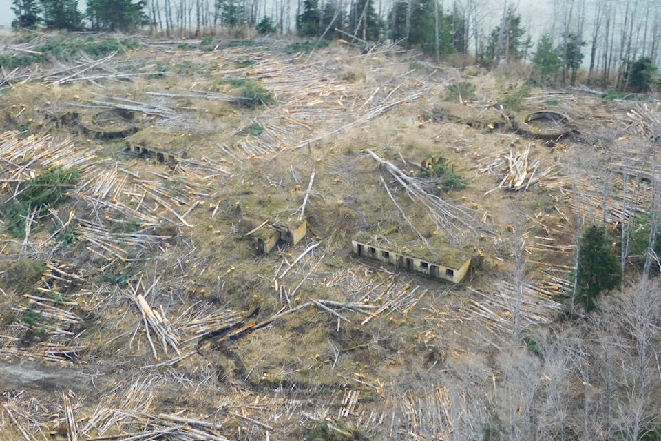
Currently, the Prince Rupert Port Authority is clearing the land surrounding the WWII Barrett Fort structures, removing trees and overgrown vegetation as they prepare to begin rock excavation for the connector corridor road and rail sidings between the Fairview Container Terminal and Ridley Island.
When the clearing operation was noticed and photos posted online, there was concern expressed on social media as to the potential fate of — what many are calling — a heritage site. Although public access to the site has been restricted for years, the WWII fort had been a popular place to retrace the footsteps of men long gone.
“Part of why that clearing is happening right now is to ensure that when the rock excavation work begins, that we know exactly where we’re digging into and, as it happens, that area does not impact the structures,” said Ken Veldman, the director of public affairs for the port authority.
The project, Veldman said, is critical for the continued expansion of the terminal and intermodal trade. Once it’s complete, container-related truck traffic will be redirected through the corridor, bypassing Prince Rupert’s downtown core.
READ MORE: New road coming for Fairview Terminal
The first time the land was cleared was 80 years ago.
Phylis Bowman’s book, Second World War Memories, states that between 1937 and 1938, British military officers chose the southern tip of Kaien Island and across the harbour on Digby Island’s southwesterly end to build gun batteries. In 1939, the gun turrets were built — not yet armed with weapons — before the onset of the Second World War.
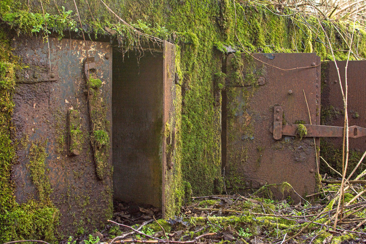
What came to be known as Barrett Fort, or Second Fort, was the largest station to guard Prince Rupert Harbour.
Barrett Fort was made up of several structures. Sitting further back on Mount Hays is an observation post, outfitted with a six-room planning station. Closer to the water, but camouflaged to passing vessels, were searchlights used to scour the deep, dark waters of Prince Rupert Harbour for enemy vessels. The three gun turrets sit between the mountain and the harbour. Underground storage held ammunition, which would be raised to the surface by a pulley system.
At one point, the men stationed at Barrett Fort built a gymnasium and opened it with a dance party on July 8, 1941. The men from different Canadian regiments would rotate through the fort, where they would stay for six weeks at a time.
When Pearl Harbour was bombed by the Empire of Japan on Dec. 7, 1941, Prince Rupert was identified as a strategic location for protecting Canada’s west coast. The population of the city is estimated to have tripled with the influx of wartime personnel from approximately 7,000 people to nearly 21,000.
READ and WATCH: Rangers restore hidden monument to fallen WWII soldier
Prior to Fairview Terminal’s Phase II expansion, potential impacts of the development were investigated. In the 2012 report, the port authority and CN were aware that Rupertites still visited the historic landmarks, but considered it trespassing on Crown land — and that nothing would be done to protect what is left of the WWII fort.
Veldman told the Northern View that the port’s most recent project isn’t likely to affect the WWII structures.
“It won’t. It’s important to note that while it’s in the vicinity, the rock excavation work is not planned for the specific area that the WWII structures are specifically located.”
The 2012 study, however, states: “Site investigations indicate that five sites are likely to be removed during project construction. These include … the Fort Barrett Searchlights. An additional four sites will potentially be affected.”
Still, the report concludes impact from the port’s activities in the area will be “negligible.” It points to years of damage already done by the railway and the City of Prince Rupert. It determined, in a chart on Page 305 of the document, that any impact on the WWII military fortifications caused by work by the port would be irreversible, yet not significant.
When asked if the Prince Rupert Port Authority has any plans to catalogue what’s there or create a display at the Port Interpretive Centre, Veldman said, “No, we don’t and we never have. For that matter, we don’t currently have any projects being considered that would specifically impact those former military structures.”
He continued that, if the structures were to be impacted, the port wouldn’t do it “under the cover of night.”
Fairview Terminal PhaseII Expansion Project Report.Oct2012 by Newsroom on Scribd
READ MORE: ‘Secret garden’ undisturbed by potential breakbulk facility