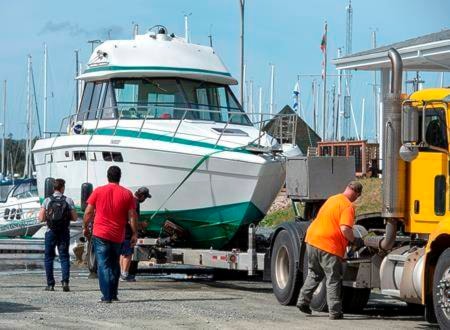
Hurricane Dorian is expected to make landfall in Atlantic Canada Saturday with winds of 100 kilometres per hour, driving rain and pounding coastal surf — conditions that had emergency officials warning Friday of the potential for significant damage across the region.
The Canadian Hurricane Centre said Friday that a hurricane warning was in effect for central and eastern Nova Scotia, and a hurricane watch was is in effect for southwestern Newfoundland.
Tropical storm watches were also in effect for western Nova Scotia, southeastern New Brunswick, Prince Edward Island, the Magdalen Islands and northwestern Newfoundland.
“We expect it to make landfall as a hurricane and then we expect it to move towards Newfoundland into the Gulf of St. Lawrence and then become a post tropical storm at that particular stage,” said Bob Robichaud, the centre’s warning preparedness meteorologist.
“But it will be a hurricane-strength post tropical storm, meaning we still have hurricane force winds associated with that storm.”
Robichaud said initial high winds would be felt in southwestern Nova Scotia earlier Saturday with the centre of the storm expected to land near or just east of Halifax by Saturday evening.
“What we should expect are things like uprooted trees, broken trees — that may result in extended power outages,” Robichaud said.
The forecast was calling for severe winds and torrential rain, with a major impacts for southeastern New Brunswick, Prince Edward Island, Nova Scotia, western Newfoundland and Quebec’s Lower North Shore. The highest rainfall amounts — 50 to 100 millimetres — were expected over western Nova Scotia, western Prince Edward Island, extreme eastern and southern New Brunswick and the Magdalen Island.
In Nova Scotia, the RCMP issued a public safety appeal, warning of hazardous conditions, decreased visibility and conditions for hydroplaning on roads and highways.
“The RCMP encourages the public to maintain a safe viewing distance along beaches and shorelines, well away from the water’s edge and stay completely off rocks, breakwaters, and piers where waves are breaking,” the Mounties said in a news release.
As of late Friday afternoon, Dorian was positioned off North Carolina and was moving northeast at 32 kilometres an hour with maximum sustained winds of 148 kilometres an hour.
READ MORE: ‘Please pray for our Bahamasland,’ Canadian victim wrote before Dorian hit
The Canadian Press
