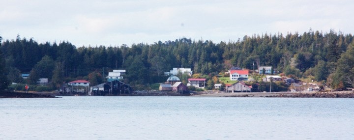
Both Prince Rupert and Port Edward saw a population decline in the past five years, revealed the latest 2016 census data.
While British Columbia's population has grown by 5.6 per cent over the past five years, Prince Rupert declined by 2.3 per cent and Port Edward fell by 14.2 per cent.
Statistics Canada released its 2016 population and dwelling counts on Wednesday, showing that in 2016 Prince Rupert had a population of 12,220 and Port Edward had a population of 467. BC Stats also released its report on population recently, showing different numbers — Prince Rupert at 11,261 and Port Edward with 474 people.
Overall, B.C. has hit 4.6 million people, and is the sixth fastest growing province in the country behind Nunavut, Alberta, Saskatchewan, Manitoba and the Yukon.
Canada's population, meanwhile, has surpassed 35 million, with the bulk of that five-per-cent growth attributed to immigrants.
As of 2016, 13.6 per cent of Canadians live in B.C., leaving the province the third largest in the country.
Out of B.C.'s 29 regional districts, 23 grew while six shrank.
"That was Alberni-Clayoquot, Caribou, Northern Rockies, Bulkley, Skeena and Mount Waddington," said Urban Futures executive director Andrew Ramlos. "So it's predominantly the northern resource regions that saw a decline."
Ramlos said that can be attributed to higher and lower job numbers.
"We saw the most employment growth in the Lower Mainland, Victoria and the Okanagan area," he said.
While the 2016 age distribution data is yet to be released, Ramlos said the declining employment in rural regions push out mid-career workers, while increased jobs and education opportunities in the metropolitan areas pull in younger workers.
In sixth place nationwide, Kelowna was the fastest growing census metropolitan area, or CMA, outside of the prairies. Victoria was the eighth fastest, Vancouver the 11th and Abbotsford-Mission the 13th.
Victoria was the only CMA to grow at a faster rate between 2011 and 2016 than between 2006 and 2011.
That growth, Ramlos said, highlights the continuing trend of larger metropolitan areas growing faster than the rest of the province.
"If you lump the two major metropolitan areas together, Greater Vancouver and the Capital District, those two regions alone accounted for about 70 per cent of B.C.'s population growth.
"What we will probably see in the fullness of time is other regions being lumped into those broad geographies as well."
He sees population growth around Greater Vancouver spreading to the Squamish-Lillooet region and growth in Victoria spreading up the eastern part of Vancouver Island to Nanaimo.
City-wise, Whistler, Sooke and Squamish grew the fastest in the province.
Vancouver has the highest population density in all of Canada, with 5,400 people per square kilometre.
Vancouver, New Westminster, North Vancouver and White Rock are the densest cities in B.C.