A new bird’s eye view of Prince Rupert can be found on the city’s website, and with it, insight into the city’s zoning, public spaces and residential properties.
At the Jan. 29 committee of the whole meeting at city council, GIS coordinator Rheannon Brooks presented the updates to the city’s map of Rupert.
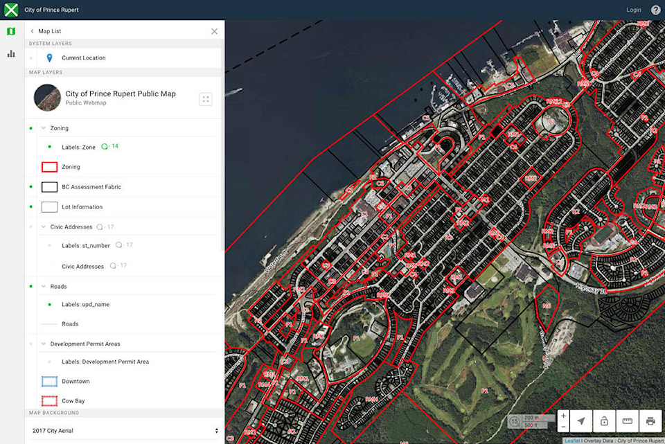
“It’s the city’s very own web map that can be used by the general public for information retrieval using an intuitive spacial interface,” Brooks said during her presentation.
“It’s for homeowners, city staff, realtors, developers or anybody else who’s interested in retrieving basic information about the city.”
READ MORE: $200,000 increase for city workers
Laid out much like Google Maps, the GO-Map uses an aerial photo taken in 2017 as its background. Brooks demonstrated how users can select layers to find out information about public and residential properties, such as addresses, property ID, lot, block and plan number and a legal description. Additional layers reveal information including a link to the zoning bylaw a property falls under.
A BC Transit layer shows the bus routes, stops and shelters as well as a link to the bus schedule. Residents can look up their garbage collection area with a link to the annual collection schedule. The cemetery can be explored by section, block, lot and plot. A connection to the city cemetery database can be used to search for people buried there.
Brooks said it’s important that the GO-Map not be used as a replacement for a legal survey, plot plan or site survey. Additional legal information, aside from the description provided, can be found at city hall.
A disclaimer on the map states: “The City assumes no obligation or liability for the use of GIS MAP by any person and makes no representations or promises regarding the completeness or accuracy of GIS MAP or its fitness for a particular purpose. GIS MAP represents a one-time capture of information as it exists at the time the information is transferred… and does not necessarily include the ongoing updates or corrections to the source databases maintained by the City or other agencies.”
When Councillor Joy Thorkelson asked Brooks if the map showed access to public utilities, undeveloped lots and underground streams, Brooks said that more layers can be added, and city staff have internal access to other layers.
READ MORE: Overnight tsunami threat triggered alarm in Port Edward, while much of Prince Rupert slept
keili.bartlett@thenorthernview.com
Like us on Facebook and follow us on Twitter